National planning policy is set out in the National Planning Policy Framework (NPPF) 2024. The NPPF applies as a whole to National Landscapes as it does to non-designated areas and sets out that planning policies and decisions should [inter alia] recognise the intrinsic character and beauty of the countryside. Paragraphs 189 and 190 refer specifically to National Landscapes. The NPPF and the accompanying Planning Practice Guidance form important material considerations about development management and confirm that:
“Great weight should be given to conserving and enhancing landscape and scenic beauty in National Parks, the Broads and National Landscapes, which have the highest status of protection in relation to these issues, and the scale and extent of development within these areas should be limited.” (Para 189)
“When considering applications for development within National Parks, the Broads and National Landscapes, permission should be refused for major development other than in exceptional circumstances, and where it can be demonstrated that the development is in the public interest. Consideration of such applications should include an assessment of:
a) the need for the development, including in terms of any national considerations, and the impact of permitting it, or refusing it, upon the local economy;
b) the cost of, and scope for, developing outside the designated area, or meeting the need for it in some other way; and
c) any detrimental effect on the environment, the landscape and recreational opportunities, and the extent to which that could be moderated.”
In practice this means that:
· The scale and extent of development in National Landscapes should be limited
· The presumption in favour of sustainable development does not automatically apply within National Landscapes (where the application of policies in the Framework that protect areas or assets of particular importance provides a clear reason for refusing the development proposed, OR where any adverse impacts would significantly and demonstrably outweigh the benefits, when assessed against the Framework taken as a whole)
· There is a presumption that planning permission should be refused for major development in National Landscapes other than in exceptional circumstances and where it can be demonstrated that the development is in the public interest
· Policies for protecting National Landscapes may mean that it is not possible to meet objectively assessed needs for housing and other development in full (where the application of policies in the Framework that protect areas or assets of particular importance provides a strong reason for restricting the overall scale, type or distribution of development in the plan area)
· National Landscapes are unlikely to be suitable areas for accommodating unmet needs arising from adjoining, non-designated, areas.
The Protected Landscapes Duty
The Levelling-up and Regeneration Act (2023) amended S.85 of the Countryside and Rights of Way (CRoW) Act (2000) to place a new duty on Relevant Authorities. This seeks to ‘further the purpose of designation’ in National Landscapes, rather than simply having a duty of ‘regard’ as previously. This is a significant, beneficial change. The list of Relevant Authorities runs to several thousand, but chief among them are all public bodies (including local authorities and Arms-Length Bodies) and utilities. Seeking to further the purpose is not a passive duty and is not ‘business as usual.’ It actively requires those to whom it applies to take positive action to seek to further the purpose, and to be able to evidence how they have done so.
This management plan provides outcomes and measures that help to identify what constitutes ‘seeking to further the purpose’ in the Forest of Bowland context.
Local Planning Policy
Each of the relevant local and minerals planning authorities has policies aimed at supporting the conservation and enhancement of Bowland’s natural beauty and cultural heritage. As this management plan ‘formulates the policy of local authorities in relation to their AONB’ (S89. CRoW 2000) it is anticipated that it will guide further National Landscape-specific policy in any reviews of Local Plans and guide the day-to-day approach of local authorities to issues affecting the National Landscape.
The key role of planning authorities in conserving natural beauty
The Local Planning Authorities should establish, in their Local Plans, robust policies which support the purpose of designation and protect the components of natural beauty of the Forest of Bowland. In particular these policies, and their application in decision making should:
- Ensure the LURA duty to ‘seek to further the purpose of designation’ is fulfilled through spatial planning and development management
- support the conservation and enhancement of the components of natural beauty in Bowland – see Statement of Significance
- protect the National Landscape and its setting from visually intrusive development
- promote best practice in building design and energy efficiency
- ensure the effectiveness of net gain for biodiversity
- ensure increased ecosystem service provision in policy making and development management
- promote the retention of traditional building styles
- protect heritage features
- reduce light and noise pollution and promote tranquillity
- encourage a visitor economy predicated on enjoying natural beauty
- promote sustainable transport options, including improved public transport
- promote ease of living and working in the National Landscape without compromising its environmental qualities
National Environmental Policy and Initiatives
The duty to ‘seek to further the purpose of designation’ (the conservation and enhancement of natural beauty) - The Levelling-up and Regeneration Act (2023) is a significant change for how National Landscapes must be treated by all those bodies who influence policy and practice here. This management plan provides measures that help to identify what constitutes ‘seeking to further the purpose.’
30x30 – Bowland’s contribution - Governments around the world have committed to protecting 30% of their land area by 2030 (hence 30x30). The target requires areas to be effectively conserved and managed while integrated into the wider landscape and respecting the rights of local communities. Protected areas such as the Forest of Bowland, and their dedicated teams and partnerships, are at the forefront of national work to conserve, protect and restore nature-rich habitats across our landscapes.
Initial mapping from Natural England suggests that 37.4% or 30,113.8 ha of Bowland can meet the 30x30 target (2025); this can be used to set realistic targets for Bowland’s contribution to 30x30 over the lifetime of this plan. https://www.arcgis.com/apps/dashboards/5761cf73966040258cfa3f0f59359e18
However, Natural England’s own assessment1 suggests that just 22.5% of the NL is currently being managed for nature and is in a good, or moving towards good, condition. The National Landscape Association is proposing a target of 45% for nature to be met in all National Landscapes in England.
Bowland already has areas of interconnected nature-rich habitat with many areas in sympathetic low-input management. Through protecting these areas and their inter-connectivity, along with improving the quality of habitats through investment via agri-environment schemes, LNRSs and other conservation and enhancement programmes, Bowland could further contribute to 30x30 objectives. Meanwhile it is important that the drive for 30x30 does not take nature conservation and recovery back to a site-focused approach, potentially valuing ‘protected’ fragments of land over work to conserve, enhance, expand and connect habitats which may not count as ‘protected’ but may, in combination, be even more valuable for nature.
The approach in Bowland therefore should:
· Identify wildlife-rich areas, protecting them and preventing damage from drainage, pollution, pesticides, ‘nature-negative’ management, over-exploitation, nutrient enrichment, invasive species, disturbance, and habitat destruction, and manage them to enhance biodiversity
· Buffer and link core sites to support a connected and resilient ecological network
· Restore wildlife richness to its pre-industrialised farming baseline across the wider landscape by, for example, fostering management of land for multiple objectives, investing in approaches that maximise nature recovery alongside food production, allowing natural processes to flourish, and creating structural diversity.
The Third National Adaptation Programme (NAP3) - Developed under the Climate Change Act (2008) and covering 2023 to 2028. NAP3 states that all Protected Landscapes must have a Climate Change Adaptation Plan by 2028. In the Forest of Bowland our adaptation plan forms a formal appendix to this management plan and will be consulted on accordingly.
| ASSET |
MAIN RISKS |
KEY CLIMATE CHANGE ADAPTATION ACTIONS |
| Peatlands |
Drying out of peat, and storm ‘wash outs’ |
2A Improve the hydrological function and condition of peatland through re-wetting and re- vegetating |
| Species rich grasslands |
Loss of species due to drought/flood or lack of frosts |
4A Ensure existing and potential species-rich meadows, pastures and scarce grasslands are in good condition and well connected |
| Hedgerows |
Impact of drought, and pests & diseases on hedgerow plants |
3A Manage woodlands in line with UK Forestry Standard and bring existing woodlands and hedgerows into good condition
3C Plant trees, woodlands (including riparian woodlands) and hedgerows to act as wildlife networks and natural solutions to climate change. Plant species that may be more resilient to climatic change, pests and diseases
|
| Veteran trees & Historic designed landscapes |
Impact of storms, drought, and pests & diseases |
3D Survey and retain existing significant / veteran trees in the landscape and plant new ones to act as habitat, stepping stones and future landscape features, in line with UKFS |
| Woodlands |
Impact of storms, drought, and pests & diseases
|
3A Manage woodlands in line with UK Forestry Standard and bring existing woodlands and hedgerows into good condition
3C Plant trees, woodlands (including riparian woodlands) and hedgerows to act as wildlife networks and natural solutions to climate change. Plant species that may be more resilient to climatic change, pests and diseases
3I Support research into future woodland resilience to climate change, pests and diseases
|
| Species abundancy & diversity |
Impact of storms, drought, and pests & diseases
|
6H Deliver habitat and species conservation measures at a landscape scale, increase habitat connectivity and undertake adaptive management to increase species diversity and abundancy |
| Headwaters, streams & ponds |
Impact of drought and storm events |
5F Restore and create ponds, scrapes and dams on farmland, moorland and in woodland |
| Rivers and waterbodies |
Impact of drought and storm events
|
5C Strengthen the resilience of river systems to climate change and extreme weather events, encouraging the development of nature-based solutions (e.g. natural flood management) in rivers and wetlands as climate adaptation methods
5E Restore natural processes to watercourses to improve in-channel habitats, reconnect rivers to their floodplains, increase biodiversity and enhance the landscape
|
| Ground & surface water |
Drought |
5A Maintain, create and expand wetland habitats promoting good hydrological function and diverse abundant key species |
| Forestry |
Impact of storms, drought, and pests & diseases
|
3C Plant trees, woodlands (including riparian woodlands) and hedgerows to act as wildlife networks and natural solutions to climate change. Plant species that may be more resilient to climatic change, pests and diseases |
| Public Rights of Way |
Impact of drought and storm events
|
7I Utilise adaptive management techniques and practice that create and restore rights of way which are more resilient to climate change |
Protected Landscapes Targets and Outcomes Framework (PLTOF) – This is aimed at helping Protected Landscapes (the places, not just the National Park/Landscapes teams) to contribute more fully to the goals in the Government’s 25 Year Plan for the Environment. Three of the targets: 1 – new priority habitat restored or created outside protected sites; 7 – restored peatlands; 8 – increase in woodland and tree cover, are directly apportioned to each Protected Landscape; for the rest, Natural England will lead on monitoring the impacts of actions in each place. See the targets section of this plan (p26).
Planning reform and the growth agenda - In every management plan cycle there are changes to the planning system. While the Planning and Infrastructure Bill (2025) may offer local conservation opportunities through its Nature Restoration Fund, it could also weaken protections. The Government’s own environmental impact assessment confirmed that there is no data or evidence to support a view that nature is a ‘blocker’ on development and growth, and any new legislation will need to reflect the importance of protecting natural beauty for the multiple benefits it brings. Thriving nature is essential for a thriving economy.
The Land Use Framework – This will set out a vision for land use in England and is intended to act as a tool to drive better decision-making on how land is used and managed maximising win-wins and managing competing demands. In developing this Management Plan account has been taken of the ongoing process towards producing the framework.
Biodiversity Net Gain (BNG) is now mandatory for new development - There will be opportunities to use BNG to further conservation in the National Landscape. This management plan provides measures that should be incorporated into BNG proposals locally.
Nutrient Neutrality – this requires that new development does not increase nutrient pollution (such as nitrogen or phosphorus) in sensitive habitats protected under the Habitats Regulations. Development proposals must demonstrate effective mitigation - such as wetlands creation, buffer zones, or off-site offsetting - to avoid harm to nearby rivers, lakes or estuaries. This should be seen in concert with other protections for National Landscapes, ensuring both ecological integrity and landscape character are safeguarded, while balancing the need for sustainable growth.
Updates to UK Forestry Standard (2024) – The UK Forestry Standard (UKFS) is the technical standard for sustainable forest management in the UK. By setting out the approach of the 4 UK governments it provides guidance for foresters on how to practice sustainable forest management Updates to the UKFS are aimed at helping owners and managers mitigate the impacts of climate change, reduce the impacts of pests and diseases and support nature recovery alongside commercial woodland management objectives. This will enable an increasingly nuanced approach to expanding woodland, scrub and tree cover in Bowland.
The Cunliffe Review – the 2025 report produced by the Independent Water Commission, is aimed at rebuilding public trust in the water sector, improving services and protecting the water environment. This proposes the creation of a single integrated water regulator and nine regional water planning authorities. A 25-year national water strategy which will follow should ensure an integrated approach to the water environment, focusing on the health of watercourses, standing water and the hydrological function of peatlands to provide multiple public benefits and protect nature.
Local context
Local Nature Recovery Strategies - Local Nature Recovery Strategies (LNRS) in England are established under the Environment Act 2021. They are created on administrative (at least county or unitary authority) boundaries and are intended to map out and guide actions for restoring and enhancing nature across the whole country. The Forest of Bowland National Landscape has its own Nature Recovery Plan, which is recognised by partners locally as both influencing, and being influenced by, the LNRS for Lancashire and for North Yorkshire and York. Management implementation monitoring will be used to feed into LNRS monitoring, and vice versa, wherever possible. The Local Authorities charged with producing the two relevant LNRS are members of the Forest of Bowland National Landscape Partnership and Joint Advisory Committee.
Public Rights of Way Improvement Plans (ROWIP) and Local Cycling and Walking Infrastructure Plans (LCWIP) exist for both Lancashire County Council and North Yorkshire Council. These fall under the broader Local Transport Plans. The ROWIP’s manage and enhance paths for walkers, cyclists, equestrians, and people with mobility issues. They focus on creating a more connected, accessible network, often replacing stiles with gates, improving signage, and reviewing the network's legality. LCWIP’s also provide a strategy for infrastructure to enable and encourage people to travel via active modes with the eventual effect of reducing congestion and improving public health. Both the ROWIP and LCWIP’s are integrated into their respective Local Authorities Local Transport Plans which also cover public transport policy.
Asset Management Plan (AMP) 8 and its local impact – The current AMP for England’s water industry sets out three main priorities for spending. One of these is nature-based solutions, which brings opportunities for resourcing relevant conservation work at scale across Bowland, in collaboration with United Utilities and Yorkshire Water. During this National Landscape Management Plan cycle there will need to be strategic planning for AMP 9, which should be guided in part by the priorities set out in this plan.
Local Government Reorganisation and Devolution – Local government reorganisation is proposed for Lancashire by 2028, and this will create a different public sector landscape during the lifetime of this plan. This may simplify governance and concentrate responsibility and may affect funding commitments and in-kind support provided by local authorities, but the National Landscape’s governance will still require a degree of independence regardless of the outcome.
Wider general context
The central role of farming, but at a time of real uncertainty and change – Farmers and land managers will play the central role in conserving and enhancing nature in Bowland. However, despite the roll-out of elements of government support via Environmental Land Management, this is still a time of great uncertainty. There was an unrivalled opportunity to rethink agricultural support towards a focus on public money for public goods, with results-based payments directed in the main towards outcomes rather than prescriptions. However, only in the Landscape Recovery strand of ELM (which must expand over the lifetime of this plan), has this outcomes-focused approach begun to be realised. It brings an opportunity to develop a longer-term vision which many would welcome, though there is also a balance to strike, in that current 5-year agreements may be too short, but a 30-year horizon is too far off for many, especially tenants. Some local tailoring may be required.
There has also been some progress in supporting the farming community to further expand their work for people and nature, including through the creation of the Farming in Protected Landscapes programme and the Higher Tier scheme, but more progress is needed.
If society is going to change the social contract with farmers, seeking more nature-friendly farmed landscapes, farmers must have the necessary mechanisms, and the right capital and revenue incentives, over timeframes they want to work on, supported by access to good quality joined-up and consistent advice.
The continued decline in our biodiversity — locally, nationally and globally — There is an increasingly urgent need to arrest and reverse the well-documented declines in nature. There must be action, at the largest scale possible, to conserve, enhance, restore, expand and connect habitats like never before, and to support species recovery with the same urgency.
Adapting to a changing climate – In our Protected Landscapes, the drive must be for building resilience, in nature-based solutions, and the multiple benefits that can be accrued from sensitive expansion of tree cover, restoration of peatlands, low-carbon farming practices, improving soil and water quality, reducing flood risks and improving the condition of semi-natural habitats. These natural solutions are reflected in the Climate Adaptation Plan which forms part of this management plan.
Inequalities in access to nature – There is a well-documented increasing disconnect between people and their environment, just as there is a well-documented positive link between engagement with nature and people’s health and well-being. Access to nature is not equitable, for multiple social, cultural and economic reasons, and there are genuine barriers to overcome.
Green finance - Private finance for nature is growing, but current markets for carbon and biodiversity remain immature. Potential support is available via Nature North and Great North Bog, however, for both peatland restoration and general nature recovery initiatives. In the context of Bowland peatlands there has been limited progress in realising the potential benefits of the IUCN UK Peatland Code. Biodiversity Net Gain is new and relatively unproven (and though involving private finance it is associated with development and is not a carbon or nature market per se). Environmental, Social and Governance (ESG) investments can deliver tangible benefits at scale, however they require an increase in capacity to nurture relationships, and they are vulnerable to economic shifts. There is no ‘green finance silver bullet’ at this point. There is an important role for the National Landscapes Association to play here, potentially aggregating investible propositions and linking investors with landowners/managers and project developers.
Public sector financial constraints – Public funding remains tight. Protected Landscapes are still underfunded—receiving only a third of the £36m (2025 equivalent) once deemed necessary. Whilst this is not just a management plan for the Forest of Bowland partnership team, general constraints on public investment in nature, farming and access to the landscape will inevitably impact on the conservation and enhancement of natural beauty.
Bowland’s Natural Beauty
Statement of Significance
The Forest of Bowland is treasured by so many thanks to its unique character and sense of place. The interplay of nature and human interaction over many centuries has resulted in a landscape of great beauty and diversity, which feels "wild" but accessible.
Bowland's natural beauty encompasses everything that makes this landscape distinctive: its geology, topography, climate, soils, flora and fauna. It also embraces the area's archaeological, architectural and industrial heritage, along with its farming history and key cultural elements.
The National Landscape has few large settlements and has an estimated population of just 17,500, although over one million people live within a 30-minute journey. Still relatively undiscovered, the Forest of Bowland holds a special place in the heart of visitors who have discovered the beauty of this captivating landscape.
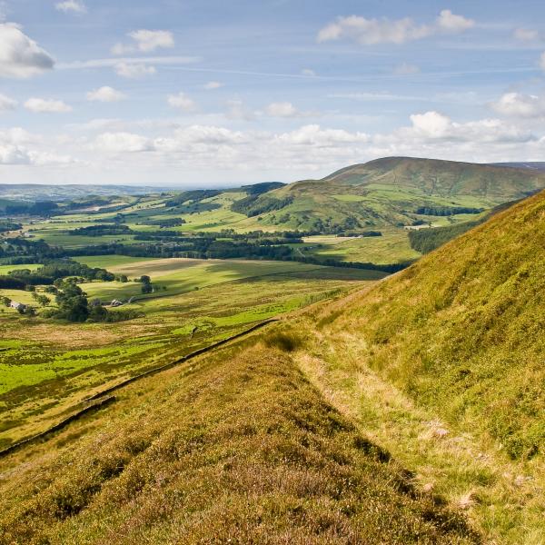
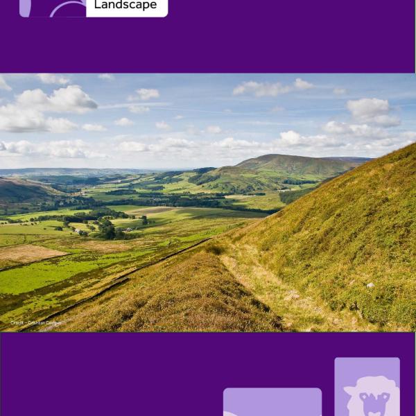
This appeal, in part, comes from the combination of contrasting but complementary scenery in close proximity. The grandeur of the upland gritstone fells, heather moorland and steep escarpments provides an impressive backdrop to the more intimate scale of scattered, stone-built farmsteads, small villages, undulating farmland and wooded river valleys; these being woven together by steep-sided cloughs, dry stone walls and hedgerows, and all underpinned by a tangible sense of tranquillity.
The Forest of Bowland is a landscape justifiably recognised as being amongst the most precious in the country.
In order to continue to deliver and develop management practices which help to conserve and enhance the area's natural beauty, we need to identify those components which make the Forest of Bowland so special.
Landscape Character
Landscape character is that which makes an area unique or different (rather than better or worse) from neighbouring areas. The Forest of Bowland Landscape Character Assessment breaks down the landscape into 13 Landscape Character Types and a detailed description of each of these LCTs can be found in the full document: www.forestofbowland.com/Landscape-Character-Assessment
The key characteristics of the Forest of Bowland National Landscape are identified below.
The grandeur and isolation of Bowland's upland fells are central to the National Landscape's identity. Their imposing presence, expansive views and sense of remoteness are key elements of the area's landscape character. With few visible signs of human activity, the moorland plateaux offer the chance to experience a feeling of real solitude. The highest point at Ward's Stone (561m) lies within the internationally recognised Bowland Fells Special Protection Area. The summit of Pendle Hill – a distinctive outlier to the south east of the main Bowland mass – reaches 557m. Landcover is predominantly blanket bog or heather moorland.
Associated Landscape Character Types include:
LCT A – Moorland Plateaux
The steep escarpments and distinctive rounded profile of the moorland hills create dramatic landforms. Although ice and glacial deposition have softened the slopes of the hills, they are often deeply incised by cloughs created by fast flowing streams. The moorland hills afford long, generally uninterrupted views to the lowlands, across a mosaic of heather, bilberry, bracken and steep wooded valleys. The broad sweep of Parlick to Totridge beyond Chipping, Craggs Dole to Saddlers Height above Sabden and Beacon Fell near Longridge provide good examples of this landscape. Enclosed by drystone walls and fences, often unimproved moorland with traditional field barns provides a transition from higher ground. On the very edges of the Forest of Bowland, west of Quernmore and south east of Pendle Hill, rounded ridges with open views rise from the surrounding lower land.
Associated Landscape Character Types include:
LCT B – Unenclosed Moorland Hills
LCT C – Enclosed Moorland Hills
LCT D – Moorland Fringe
LCT K – Rolling Upland Farmland
LCT M – Farmed Ridges
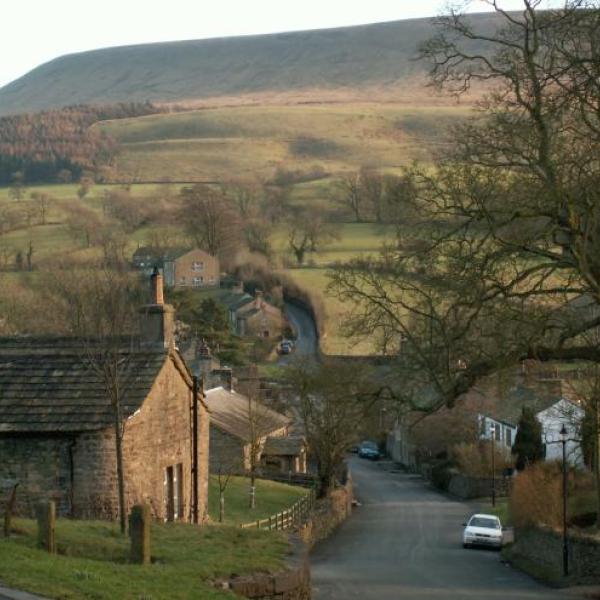
As the view moves from the uplands, undulating lowlands take centre stage. Predominantly farmland, this landscape is a patchwork of pastures, meadows and copses divided by dry stone walls and hedgerows dotted with mature trees. Winding lanes with herb-rich verges cross hump backed bridges to link scattered farmsteads and stone-built villages, forming distinctive settlement patterns. In several places, such as Wyresdale, Browsholme and Downham, "designed" parklands reflect Bowland's long history of estate management. Rounded glacial drumlins occur in the very north of the National Landscape. Throughout, the backdrop of the fells provides a sense of intimacy and enclosure, the fells being linked to lower lying land through wooded tributaries.
Associated Landscape Character Types include:
LCT E – Undulating Lowland Farmland
LCT F – Undulating Lowland Farmland with Wooded Brooks
LCT G – Undulating Lowland Farmland with Parkland
LCT H – Wooded Rural Valleys
LCT J – Drumlin Field
Bowland is a landscape of contrasts, often with many elements being visible from a given point. The panorama from Pendle Hill is a classic example. Here, the view north west takes in sweeping gradients down to hedge-lined fields with out-barns and pockets of woodland, to the wide valley of the River Ribble with its larger settlements and areas of industry, then upwards to the central fells beyond – this canvas is peppered with scenic villages, hamlets and isolated farmsteads. Looking south east offers a very different perspective, with the Leeds Liverpool Canal and the M65 motorway weaving their way past the urban towns of Colne, Nelson and Brierfield, the whole framed by its own moorland backdrop. When journeying through the area, this impression of a new view around each corner contributes greatly to the Forest of Bowland's sense of place: the landscape offers variety on a human scale.
These characteristics encompass multiple Landscape Character Types, including:
LCT I – Valley Floodplain
LCT L – Forestry and Reservoir
People value the National Landscape for its serenity and tranquillity. The absence of workable coal reserves, a long tradition of farming and the historical management of much of Bowland as royal hunting forests and, later, deer parks and grouse moorland, restricted development. This has resulted in small scale settlements, very few main roads and no railways within the core of the area. Although Bowland has its honey-pot sites, these are relatively few and it is still entirely possible to experience peaceful, secluded locations, enriching wildlife encounters and truly dark skies.
These characteristics are found across a variety of the Forest of Bowland's Landscape Character Types.
Biodiversity Key Habitats & Species
The Forest of Bowland National Landscape Nature Recovery Plan (December 2023) identified six broad, interconnected habitat types and fourteen ‘Champion’ species at its heart. The full plan, from which these summaries are compiled, can be viewed here: www.forestofbowland.com/nature-recovery. The habitat types below represent the mosaic of habitats most important for developing a resilient network of functioning ecosystems. Similarly, whilst the National Landscape is rich in hundreds of plant and animal species, the "Champion" species highlighted here represent those of conservation concern, those which are charismatic and provide inspiration, or those which indicate the health of an ecosystem or habitat.
Habitats
Over a quarter of the National Landscape is peatland, with the Bowland Fells Special Protection Area being the most extensive. Covering over 16,000 hectares, the Bowland Fells supports rare and endangered species and is of international importance for biodiversity, carbon storage, natural flood management and water quality. These upland areas are used for sheep and beef farming, alongside the management of moorland for grouse shooting.
Woodland covers 8% of the National Landscape area. Found on steep-sided cloughs and along river valleys, dense broadleaved woodland provides a rich and diverse habitat for wild plants, invertebrates, birds and mammals. Calf Hill and Cragg Woods SSSI is one of the best examples of Atlantic oak woodland in the British Isles and across the world. Originally planted for timber, conifer plantations can provide important habitat for nightjar and crossbill. Large scale plantations include those at Gisburn Forest, Longridge Fell and Knots Wood. Individual, veteran and 'Landmark’ trees occur across the National Landscape; most being found in parkland and along roadsides. The micro-habitats in hollowing trees and other decaying wood support a wide range of specialised invertebrates, lichen and fungi. "Landmark" trees are important to the unique character of the area and can be both native and non-native species. Native hedgerows form traditional boundaries and cultural features across the landscape and contribute greatly to the wooded "feel" of Bowland. They are important habitats for birds, mammals and invertebrates, both in and of themselves, and as wildlife corridors. Many hedgerows feature mature hedgerow trees, adding to their impact in the landscape.
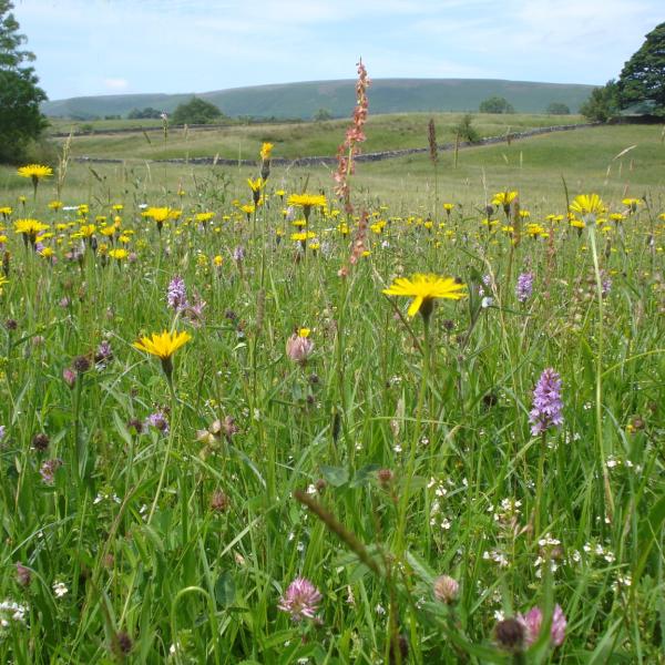
Large areas of the National Landscape are dominated by grassland. Bowland is home to a significant number of the UK's remaining upland hay meadows (Lancashire's Coronation Meadow can be found in Slaidburn) with 77 hectares recorded. Ancient grasslands, undisturbed and unimproved, are irreplaceable. Often containing important indicator fungi, the mycelium in the ground can take centuries to re-establish. Areas of marshy grassland are widespread on the lower moorland slopes around the Bowland Fells. They provide part of the mosaic of habitats required for successful black grouse re-introduction and support important wading birds such as snipe. Semi-improved and improved permanent pasture accounts for 67% of farmland within the National Landscape. Supporting sheep, cattle and dairy farming, these areas are essential in supporting landscape scale habitat restoration, healthy and resilient soils and greater habitat resilience.
A mixture of upland fens, flushes and swamps, along with lowland fens, floodplain grazing marsh and wet grassland make up Bowland's wetlands. Often rich in plants and invertebrates, they provide feeding ground for wading birds in spring, and areas for wildfowl in winter. Around 13% of Bowland's upland fens, flushes and swamps are designated SSSI, with a further 10% of the area's lowland fens holding this distinction. Each of these habitats supports high concentrations of invertebrates including craneflies, beetles and spiders. Large areas of floodplain grazing marsh are found along the wide, low lying areas of the Rivers Lune, Hodder and Ribble, with wet grassland occurring alongside this habitat, along water courses and on grassland. Both are characterised by temporary wet areas and often have tussocky areas and damp swards.
The Rivers Ribble, Hodder, Lune and Wyre all originate in the upland core of the Bowland Fells. The headwaters provide some of the best breeding grounds in Lancashire for Atlantic salmon, grayling, brown trout and sea trout. Several reservoirs draw water from the area's river catchments to provide good quality drinking water, with Stocks Reservoir being important for its rare mosses and liverworts. Ponds provide habitat for a range of freshwater plants and invertebrates, feeding areas for bats, and feeding and breeding areas for voles, toads, newts and frogs. Once numerous, ponds are now found in only a few places across farmland and woodland. The National Landscape has been identified as a Strategic Opportunity Area for creating ponds to support great crested newts.
Species
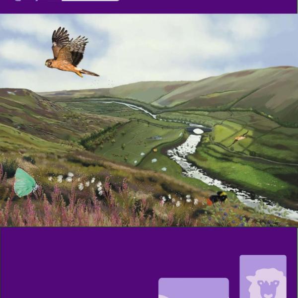
Globally under threat and continuing to decline nationally, the Forest of Bowland is critically important for the Eurasian curlew, and maintaining populations remains a priority. The National Landscape is one of the most important areas in England for breeding hen harriers – an iconic, and exceptionally rare, upland bird. In 2023 around 22% of the breeding population nested in the area. Black grouse were once widespread in the Forest of Bowland, connected with a larger population in the Yorkshire Dales. Considered locally extinct by the mid-1990s, the Bowland Fells have been identified as an area to promote expansion of black grouse through continued habitat enhancement. Summer visitors to Bowland, swifts sleep, eat, bathe and mate on the wing. Like the Eurasian curlew, they are globally threatened, with climate change and severe weather events potentially affecting migration patterns. Pied flycatchers can be found in the Forest of Bowland’s ancient and Atlantic oak woodlands. Over wintering in West Africa, they arrive here to breed in summer. Increased connectivity between woodlands is needed to support the expansion of this nationally declining species.
Juniper is a native moorland coniferous shrub. It is in decline in Bowland and restricted to just a few sites in the northern fells. As existing populations are ageing and none of the colonies appear to be producing new seedlings, grazing management and new planting could help support regeneration. Globeflower was once abundant in Bowland but is now found in only a small number of locations within species-rich grassland. Using local, sustainably sourced seed, globeflower seedlings are being propagated and planted out as part of the Bowland Hay Time project, helping to support this spectacular species and the Chiastocheta flies associated with it. Hard-fern can be found in the National Landscape’s ancient and Atlantic oak woodlands in damp, shady gorges, on banks, rocks, and walls. It is easy to spot with its feather like, leathery foliage and spotty undersides. Not under threat, it is a good indicator of Atlantic oak woodland habitat.
Brown long-eared bats are a protected species in the UK, along with their roosts. A medium sized bat with huge ears, they have a slow, fluttery flight. Feeding at night, these bats roost in holes in trees, old buildings, lime kilns and caves. Although not under threat nationally, management of ancient and mature woodlands and traditional buildings and features can help provide habitat.
The pale pink ballerina waxcap fungus is rare and vulnerable to extinction due to declines in ancient grasslands across the National Landscape. Usually found in natural and semi natural pastures and meadows, occasionally it can be found in churchyards and the lawns of historic buildings. As the mycelium it relies on takes centuries to develop, retaining ancient grasslands is the only way to support its conservation and expansion.
Native wild brown trout can be found in unpolluted rivers and streams with cold water and gravel areas for spawning. They have been in decline across the National Landscape since 2014 and are vulnerable to changes in water flows and periods of drought. Work to re-naturalise rivers, through removing in-river structures, is ongoing. Sensitive to pollution, Yellow May dun are an indicator of good water quality and a favoured food of brown trout. They are easily identified from the yellow body, transparent lacy wings and two long tails. Along with clean water, they need gravel and vegetation to support their lifecycle. The bilberry bumblebee is distinctive, with extensive red marking over its abdomen. It is nationally scarce and in serious decline. Queen bees feed almost exclusively on bilberry stands but a mosaic of habitats, including heath and species rich grasslands, are needed for foraging. The eye-catching green hairstreak butterfly is widespread across England but has undergone local losses in some parts of the UK. It lives and feeds on upland heath habitat that can be vulnerable to climate change and changes in land management. In the National Landscape it can be found feeding on plants in species-rich grassland, blanket bog and heathland.
Landscape History and Built Heritage
Early human influences on Bowland's landscape remain visible today, most obviously perhaps in the Bronze Age clearance of trees from the fells. A number of prehistoric and Romano-British settlements also leave their mark in the form of defended enclosures, particularly in the north west of the National Landscape. Finds from the nationally important Bleasdale Circle Bronze Age urnfield are held at Preston's Harris Museum, whilst the round cairn on Parlick Pike is unexcavated and represents a rare survival in Lancashire. Slaidburn Archive holds some of the finds uncovered from a local Bronze Age burial mound, partially excavated in 1984. The Roman Road which ran between Manchester and Carlisle can still be traced on the ground in sections of its route through the Forest of Bowland.
Local placenames reflect the influence of Norse settlement in the Bowland area. The "pen" of Pendle denotes a hill and "holme" (as in Dolphinholme) is an area of flat land. There are several suggestions for the origin of the name Bowland itself, with the Old English boga-, or Old Norse bogi-, (“bow or bend in a river”) being one. Other early medieval connections include the silver hoard from the reign of King Cnut discovered near Halton in the early nineteenth century. Also found in Halton and nearby Hornby, Gressingham and Melling are examples of Anglo-Saxon sculpture, with a further pre-Conquest example being Slaidburn's Angel Stone.
The Scheduled Monument of Castle Stede, near Hornby, is the best example in Lancashire of a medieval motte and bailey castle and is one of a number of late 11th century mottes in the Lune valley. Sites here were chosen strategically to control movement through the valley and impose order following the Norman Conquest. Another example can be found at Castle Hill in Halton, just outside the National Landscape boundary. Founded in 1149, the Cistercian abbey at Sawley is well preserved, with extensive remains and undisturbed earthworks. Several features are Grade 1 listed.
The current National Landscape boundary includes evidence of five medieval hunting forests - land set aside for the monarchs and their nobles, where clearing and cultivation were restricted and development prohibited. The Royal Forest of Bowland, along with those at Bleasdale, Quernmore, Wyresdale and Pendle, perhaps had the greatest influence on the landscape of Bowland. As Forest laws were revoked in the early 16th century, many areas were replaced by deer parks and smaller estates. Large areas of land are now managed for grouse and other game birds. Designed landscapes are evident today at Browsholme, Downham, Gresgarth, Leagram, Quernmore and Read, for example, reflecting influences from the medieval period right through to the nineteenth century.
Bowland has many fine stone buildings which were constructed between the sixteenth and nineteenth centuries. The vernacular style, stone mullions and lintels echo locally available building materials and hint at the lives and livelihoods of the people who built them. Stephen Park in Gisburn Forest, Brabin's Old School in Chipping and Roughlee Old Hall are good examples. Datestones in villages such as Wray have quite a distinctive, stepped "Lune Valley" style, and traditional estate villages, like Slaidburn and Downham, have seen very little modern development. Isolated farmsteads string along tracks skirting the contours of the hills, and out-barns scatter the higher ground and summer pastures.
The complexity of Bowland's traditional boundaries reveals itself from almost any viewpoint. The network of dry stone walls and hedges reflect not only the underlying geology of the area, but also the history of land management. Walls tend to dominate the fells and moorland fringe, with hedges appearing on lower lying land, taking advantage of glacial drift. Ancient enclosures tend to be more sinuous in shape, with fields enclosed following the Parliamentary Acts of the mid nineteenth century often larger, with straighter, more uniform boundaries. Roadside metal railings, often white-painted, are distinctive features around villages including Chipping, Dunsop Bridge and Pendleton.
Rural industries shaped Bowland's past and much evidence can still be found today. Ashnott lead mine above Newton was worked as early as the thirteenth century, whilst silver was mined near Rimington. Evidence of medieval iron working exists at Quernmore and Roeburndale. The fells would have echoed to the sounds of working sandstone and limestone quarries in later periods. Numerous lime kilns are seen by roadsides and in-field. Established in the late eighteenth century, Clintsfield Colliery near Wennington forms part of an extensive colliery landscape from this time. The nineteenth century paper mill at Oakenclough now stands quiet, but the cotton mill in nearby Calder Vale continues to operate. Quernmore, Tarnbrook, Wray and Slaidburn were centres of hat making. Many upland farms made cheese from surplus milk, with stone cheese presses retained as features in farmyards around Bowland.
Farming is the backbone of rural life in Bowland, and the landscape is embedded with the history of generations of farming families. Surviving small scale, irregular field patterns, patches of woodland along stream and field edges, narrow, winding roads linking scattered farms and settlements, relic farmsteads and field boundaries now overlaid by forestry and reservoir all help to tell Bowland's farming story over hundreds, if not thousands, of years. Upland beef and sheep farms and lowland dairy and cattle farms continue to contribute to communities with a keen sense of self-reliance, with agricultural shows across the area providing local focal points for gathering and celebration.