Background

Until late 2023, National Landscapes were known as ‘Areas of Outstanding Natural Beauty (AONB)’, and that is still the legal name of the designation, hence the title of this plan. Other than on the title page, the term National Landscape(s) is used in this plan.

The Nature and Purpose of this Plan

This plan is produced under provisions in Section 89 of the Countryside and Rights of Way Act (2000), which itself was subject to amendment in this context by the Levelling-Up and Regeneration Act (LURA) (2023).

The plan, which is in practice a strategy, has several primary functions. It:

  • formulates the policy of local authorities in relation to their National Landscape,
  • guides the policy and practice of partners and Relevant Authorities under LURA,
  • sets out what might constitute ‘seeking to further the purpose of designation’ through the implementation of work in support of the plan’s outcomes and measures,
  • aims to inspire action for nature, climate, people and place, including guiding the team’s work and that of key partners, Farming in Protected Landscapes (FiPL) programme applications, and the content of Landscape Recovery and other ELM proposals.

The plan provides a positive and pro-active management framework for the many bodies that form the Forest of Bowland National Landscape Partnership, and others. It identifies the components of natural beauty – those things which should be the focus of conservation and enhancement – and outlines an integrated vision for the future of Bowland as a National Landscape. The plan identifies the drivers of change in the landscape today and looks at how they can be best managed and/or accommodated.

As well as the components of natural beauty, the plan also addresses how people use and interact with the landscape for their enjoyment, health, and well-being.

A series of desired outcomes are identified, alongside measures to achieve them, with broad sectoral responsibility linked to each measure.

The primary audiences for the plan are therefore:

Local Authorities at all levels Relevant Authorities under LURA

Arm’s-Length Bodies (ALBs) i.e. Natural England, Environment Agency, Forestry Commission, Historic England

Farmers and land managers, their representative bodies and providers of farm advice

Conservation Non Governmental Organisations (NGOs) and other partners

Local groups of place and interest

In short, everyone who has an influence over, or stake in, this nationally protected landscape.

Status and Purpose of the Management Plan

All National Landscape partnerships are required by law (CRoW Act, 2000) to produce a five yearly management plan. This is therefore a statutory document, although it does not set out or impose any new policy or legal obligations.

The Management Plan is….

  • A Statutory document
  • Advisory in nature
  • Often used as a 'material consideration' in planning decisions
  • Used to offer high level outcomes, guiding 'ways of working' and a suite of measures to support delivery
  • Used to support other plans and funding proposals
  • Supported by the National Landscape partnership and adopted by the local authorities which make up the landscape area. Some of the partners have regulatory powers (eg Natural England, Environment Agency) although the partnership itself is not a regulatory body
  • Led by policy, law, evidence and data and aims to deliver national and local plans that align with the statutory purposes (eg Local Nature Recovery Strategy, Environmental Improvement Plan, National Adaptation Plan)
  • For the place and the partnership, ie not the sole responsibility of the National Landscape team

A Management Plan does NOT….

  • Set out new legal or planning policy, obligations or regulations
  • Create new thresholds or prohibitions
  • Substitute for national or local policy
  • Express an opinion regarding land management techniques
  • Set out delivery plans or allocate resources
  • Offer a spatial plan
  • Provide a list of projects
  • Restrict lawful practice or land management activities


Together with National Parks, National Landscapes are unique and irreplaceable national assets

Each with such distinctive character and natural beauty that it is in the nation’s interest to safeguard them for present and future generations and manage them in the interests of everyone in society. They are also recognised globally as Protected Areas under the International Union for the Conservation of Nature (IUCN Category V).

The 38 National Landscapes in England and Wales cover approximately 16 % of the land surface. They are some of the most special and cherished places in our country. Like all IUCN Category V Protected Areas, they are also living, working landscapes that contribute billions of pounds every year to the local and national economy. Although home to less than half a million people (under 2% of England’s population), over two thirds of England’s population live within half an hour’s drive of a National Landscape and around 150 million people visit the country’s National Landscapes every year, spending in excess of £2bn.

An introduction to the Forest of Bowland National Landscape

The Forest of Bowland was designated as an Area of Outstanding Natural Beauty in 1964. It is internationally important for its heather moorland, blanket bog and rare upland birds. The components of natural beauty in the Forest of Bowland were set out in a Statement of Significance when the AONB was assessed and designated.

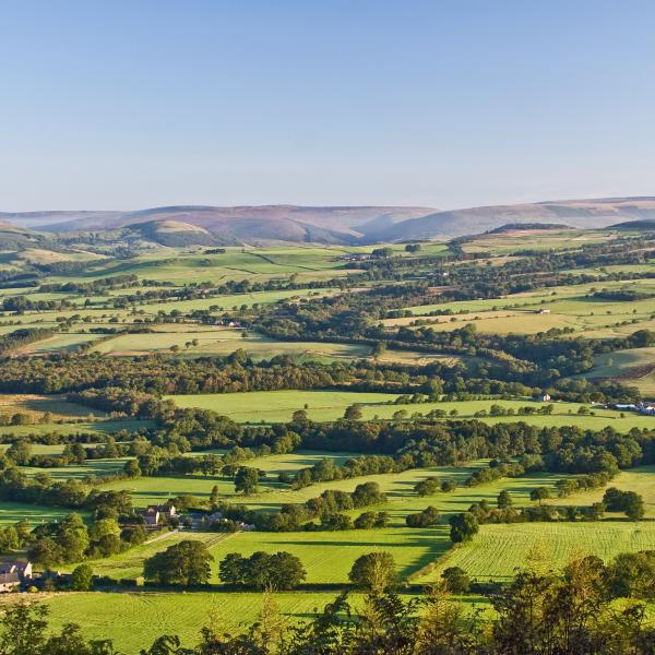
The Forest of Bowland is in North West England and covers 803 square kilometres of the Pennines (730 in Lancashire and 73 in North Yorkshire). The area is bounded to the north and south by the Rivers Lune and Ribble, respectively. To the west is the Fylde plain, while the eastern side of the boundary matches the Yorkshire Dales National Park for a short distance, with Ribblesdale bordering the remainder. On its south-eastern edge, Pendle Hill (557m) forms a discrete landscape feature, which is geologically linked to the rest of Bowland, but separated from the main area by the Ribble valley.

The Rivers Brock, Calder, Conder, Hindburn, Hodder, Loud, Roeburn, Wenning and Wyre all originate in the upland core of the Bowland Fells. The highest point is Ward’s Stone at 561m, alongside other notable landmarks such as Fairsnape Fell at 510m and Hawthornthwaite Fell at 479m.

Bowland lacks large settlements and has an estimated population of approximately 17,500 people. Its boundaries include parts of five Lancashire district council areas, namely: Lancaster, Pendle, Preston, Ribble Valley and Wyre; plus, a part of North Yorkshire Council that was formerly Craven District. The urban centres of Preston, Lancaster, Blackburn, Blackpool and Burnley are all near to Bowland, with over one million people living within a 30-minute journey of the area. Bowland is also within a 90-minute journey from the major conurbations of Liverpool, Manchester and Leeds.

The designation is overseen by a partnership of local councils, government agencies, landowners, farmers, local businesses and wildlife and recreation interest groups, who work to conserve and enhance the natural beauty of this special landscape. https://www.forestofbowland.com/Joint-Advisory-Committee

Turning the Last Plan into Action: Key Achievements since 2019

Since the last Management Plan was published, we have recorded the following achievements from within the National Landscape Team

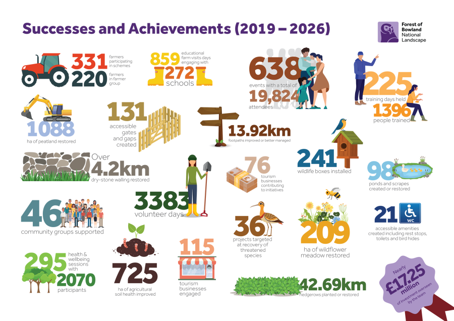
Infographic of achievements since last management plan

Successes & Achievements 2019 - 2016

Summary of the Forest of Bowland achievements listed in the infographic:

  • 331 farmers participating in schemes
  • 220 farmers in farmer group
  • 859 educational farm visit days engaging with 272 schools
  • 638 events with a total of 19,824 attendees
  • 225 training days held with 1396 people trained
  • 1088 ha of peatlands restored
  • 131 accessible gates and gaps created
  • 13.92 km of footpaths improved or better managed 
  • Over 4.2km of dry stone walling restored
  • 3383 volunteer days
  • 76 tourism businesses contributing to initiatives
  • 241 wildlife boxes installed
  • 98 ponds and scrapes created or restored
  • 46 community groups supported
  • 3383 volunteer days
  • 36 projects targeted at recovery of threatened species
  • 209 ha of wildflower meadow restored
  • 21 accessible amenities created including rest stops, toilets and bird hides
  • 295 health and wellbeing sessions with 2070 participants
  • 725 ha of agricultural soil health improved
  • 115 tourism businesses engaged
  • 42.69 km of hedgerows planted or restored
  • Nearly 17.25 million of investment overseen by the Forest of Bowland team