Towns and Villages

Gateway towns

Barrowford

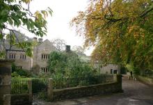
Barrowford - Pendle Heritage Centre

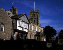
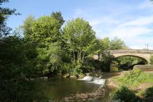
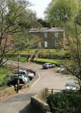
The Parish of Barrowford, which includes Carr Hall and Higherford, has a population of just over six thousand people and over 2,750 households, which has been steadily increasing over a number of years.  Barrowford is seen as a ‘desirable’ place to live, with a number of local estate agents and the pressure on available land for local house building confirms the popularity of the village as a place to settle.   Barrowford’s local identity and sense of community is partly based on its past heritage and history both built and social, the stability of local families and strong social networks, these needs to be preserved to keep Barrowford as the friendly and lively place it is today.Barrowford developed as a weaving town and in its heyday the textiles industry operated 10,000 looms in Barrowford and employed several thousand local people. The gradual decline of the textile industry has led to the development of Barrowford as a residential suburb, resulting in little current local industry or employment except for a few mill buildings converted to small Business Parks and industrial units and the yet unbuilt Barrowford Business Park.

Bentham

Bentham

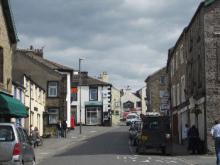
This unspoilt busy little market town stands in meadows and woodland on the banks of the River Wenning and has a traditional market every Wednesday. Often overlooked, it is only three miles from Ingleton, famous for its waterfalls and caves, and seven miles from the historic market town of Kirkby Lonsdale.The Leeds-Morecambe railway line runs through the town and the Three Peaks of Ingleborough, Whernside and Pen-y-ghent are nearby.The Yorkshire Dales National Park lies to the north and the Forest of Bowland National Landscape stretches away to the south. Bentham is truly a delightful corner of the Yorkshire Dales and provides an ideal base for walking, pony trekking, cycling or touring holidays.The Great Stone of Fourstones is just 2 miles south of High Bentham which offers breathtaking views of the Three Peaks.


Clitheroe

Clitheroe

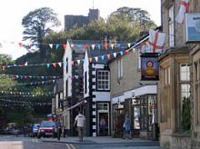
The bustling market town of Clitheroe lies in between the Forest of Bowland National Landscape's main upland block and the outlier of Pendle Hill. The town retains much of its old character and customs, and has a wide range of shops, many of which have been run by the same family for generations. A popular open-air market is held on Tuesdays, Thursdays and Saturdays.The main street of the town is dominated by a massive rock of limestone crowned with the Keep of an ancient Castle, of uncertain age, but at least 800 years old. The Castle grounds contain formal gardens, tennis courts, bowling green and summerhouse cafeteria, and a large open-air auditorium with bandstand where concerts ranging from brass band to rock music can be heard in the summer. Here too can be found the Castle Museum, well worth a visit to enjoy the exhibitions of geology and local life. Children will be fascinated with the sights and sounds of the recreated cloggers workshop, printers shop and lead mine.


Garstang

Garstang

Garstang is situated on the River Wyre. The history of this market town goes back thousands of years with Neolithic and bronze Age artefacts found in the area but there is no actual record until the Domesday Book, when it was designated as Cherestanc. In the centre of Garstang is the Ancient Market Cross restored in 1897. The Old Town Hall and Market House superseded one, which as demolished in 1755 and following a fire in 1939 the building was restored retaining its original characteristics. At the northend of the High St. opposite the old council offices stands the Old Grammer School, which was founded in 1602.One of Lancashire's oldest traditional street markets first established in the 14th century is still going strong and is held every Thursday on the High Street.


Lancaster

Lancaster - image by Jon Sparks

This city and port still retains much of its character and provides an excellent historic gateway by road or rail to the Forest of Bowland. It was originally the site of a Roman fortress and a crossing of the River Lune but it was only created a city by King George VI on 14th May 1937. Lancaster was the home of the House of Lancaster and John O'Gaunt's statue dominates the City from over the castle gateway.Dominated by its medieval castle and the River Lune that runs through the city, the narrow, Georgian streets surrounding the castle contain a wealth of attractions, shops and restaurants. The jewel in the crown in terms of attractions is Lancaster Castle. Guided tours are offered showing you around the fascinating courts and medieval dungeons.The elegant Ashton Memorial dominates the skyline in Lancaster and the surrounding Williamson Park provides a beautiful area for picnicking and enjoying the views.Other major attractions include Quayside Maritime Museum looking across the river Lune, and the Judges' Lodgings.


Longridge

Longridge

The market town of Longridge commands a view of the whole of the Fylde Plain. From the top of Longridge Fell it is possible to see the Welsh Mountains, the Isle of Man, Ingleborough and the Loud Valley. Cromwell and his army passed this way on their way to the battle of Preston. Longridge is the shopping and social centre of the local farming district and has an interesting mixture of shops and antique galleries, which attract customers from all over the region. Set in glorious countryside this is understandably a popular starting point for country walks and cycle rides.


Preston

Preston

Situated in the heart of the colourful county of Lancashire, Preston is the gateway to the surrounding beautiful landscape and historical sights. Preston is the largest and most important commercial centre in Lancashire and it attracts hundreds of thousands of visitors each year. Preston's history dates back to the Domesday Book and to 1179 with the granting of the Charter, which gave the right to hold a Guild Merchant every 20 years. The "Once in a Preston Guild" tradition continues to this day and we look forward to the next in 2012.As England's newest city plans have been agreed for a new multi-million pound redevelopment of the city centre to include major retail, leisure and cultural facilities, which will enhance the existing excellent retail offer and magnificent heritage buildings such as the Harris Museum & Art Gallery.


Settle

Settle

Settle is a bustling market town in the foothills of the Pennines amongst some of the most picturesque scenery in North Yorkshire. The town stands beside the largest outcrop of limestone in Britain - in a region of scars, cliffs, caves and potholes. At the rear of the town a zigzag footpath leads to the summit of Castleberg crag offering a vantage point of the town in its dale and fell. Settle is a good base for exploring the Forest of Bowland and the Yorkshire Dales.Settle is at its most liveliest and colourful on Tuesdays, when the weekly market takes place, attracting traders from far and wide - non-stop variety without charge. Adequate car parking space is available in the town's 3 car-parks situated within easy walking distance of the town centre. The market place is surrounded by local businesses - mostly family-owned, with some offering items for sale unique to the Settle area. The centre is dominated by the Shambles, a historic 3-storey building with shops on two levels and houses above, and the Town Hall, built on the site of the toll-booth which was pulled down in 1820.


Villages

Abbeystead

Abbeystead - image by Jon Sparks

Nothing much is known of the history of Abbeystead before the Norman Conquest, except that it was occupied from at least the middle of the prehistoric period. The name is derived from "The site of the Abbey" and relates to the short-lived presence of a house of Cistercian monks in the reign of Henry II. The traditional site of the monk's house is just below the junction of the Marshaw Wyre and the Tarnbrook Wyre, on the north side of the Reservoir.There are a number of notable buildings in the Abbeystead area - the Cawthorne Endowed School rebuilt in the 19th century, Holme Farm opposite also 19th century and Abbeystead House built in 1886 by the Earl of Sefton. Records trace the chapel to the west of Abbeystead back to the 14th century. The church was rebuilt in 1733, with a spire and new chancel added during restoration in 1894. The Abbeystead reservoir was built in 1855 by the Corporation of Lancaster to supply mills lower down the River Wyre in the dry season. Although the reservoir is no longer in service it still features an attractive curved overflow weir visible from the footpath.


Barley

Barley by Jon Sparks

Barley, or Barleegh as it used to be known, is the most popular place from which to climb Pendle Hill. The village has a large car park, picnic site and information centre to cater for the many walkers who visit, plus a pub, cafe and busy village hall. Barley was runner up in the 2007 Lancashire best kept village competition.


Bashall Eaves

Bashall Eaves

Bashall Eaves stands on the banks of the river Hodder in the parish of Mitton. Near this small hamlet can be found the Fairy Bridge, said to have been built one night by fairies to help an old woodcutter who was being pursued by witches.   Browsholme Hall is one of the most historic mansions in the district, and for centuries has been the family seat of the Parkers, former Bow-bearers of Bowland. The Hall is a handsome structure dating from the time of Henry VII, and contains a wealth of woodcarvings, arms and armour, period furniture, textiles, rare books and stained glass. Amongst the collections of paintings is one of Thomas Parker, former Lord Chancellor of England.


Bolton-by-Bowland

Bolton by Bowland by Charlie Hedley

Bolton-by-Bowland is a tranquil and charming little village, with two village greens. The smaller green contains the remains of a 13th Century stone cross and old stocks. The village was recorded as Bodeton in the Domesday Book, meaning bow in the river. The church has many ornamental carvings and a font dating from 1500, which bears the arms of the Pudsay, Percy, Tempest, Hammerton and other families. The famous Pudsay tomb has an engraved figure of Sir Ralph Pudsay in full armour with the figures of his three wives and 25 children. Overlooking the River Ribble is Rainsber Scar, which is a beautiful spot - known locally as Pudsay's leap where William Pudsay is said to have made the leap on horseback when being chased by soldiers for illegally minting his own coins.


Brock

New Bridge, Brock

The rural settlement of Brock lies at the northern end of the historic parish of Myerscough and Bilsborrow.  It sits astride A6 Garstang Road with Barton Grange Garden Centre on the west side and the site of the former Brock Station (now a community-owned small nature reserve) on the east side.  There are views of the Bowland Fells, Parlick and Fairsnape, and of Beacon Fell Country Park.  Brock Aqueduct (OS grid reference SD 506404) – a grade 2 listed structure first used in 1797 – carries the Lancaster Canal over the River Brock; (the canal towpath continues southwards from the aqueduct to Bilsborrow, Guy’s Thatched Hamlet and beyond).The riverside path from Brock into the Forest of Bowland starts at Hunters Land Rover Garage and continues upstream to FoB at Brock Bottom in the adjoining parish of Claughton.  (SD 512406 and SD 546422 respectively). There is no street parking in Brock but there is a car park at Bilsborrow Village Hall.  The buses to and from Garstang stop on A6 Garstang Road near Barton Grange Garden Centre. 

Calder Vale

Calder Vale

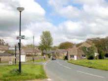
Calder Vale, despite its remote and beautiful setting is very much a working village and you can still hear the clatter of the weaving looms when the mill is working. There is little else to spoil the peace and tranquillity as there is no through road! Quakers Jonathan & Richard Jackson founded Calder Vale after surveying the area and observing that the site could be well served by water power. Their concern for the welfare of workers and their families led to workers' houses being built with gardens. In 1835 the Lappet mill was built. It was used to weave cotton and is still used today even though the River Calder no longer provides the power. The vast majority of mills have long since closed but the Lappet mill has survived by specialising in the production of Arab headdresses. Built by public subscription the Calder Vale church stands between Calder Vale and Oakenclough. Consecrated on August 12th 1863 and dedicated to St. John the Evangelist, the church contains a fine stone pulpit in memory of W.J. Garnett of Quernmore Park who gave the site.


Caton and Brookhouse

Caton

Caton lies amidst woodland and farmland in the beautiful Lune Valley. First recorded in the Domesday book, the village is thought to stem from the name of Kati (Old Norse) or C(e)atta (Old English), probably the name of an early settler with local influence. The Romans were present here, as is evidenced by the discovery of a Roman milestone in Artle Beck. In more recent times, the village grew to support several cotton mills following the industrial revolution, for example, Low Mill off Mill Lane. Whilst in the area, it is worth visiting the church in nearby Brookhouse, with a doorway dated to the twelfth century and a sixteenth century tower.


Chatburn

Chatburn

Chatburn takes its name from St Chad, an Anglo Saxon saint. Built between two ridges at the foot of Pendle Hill and near to the river Ribble, Chatburn is a beautiful village, now bypassed by the busy A59. Chatburn has a number of well known small shops and businesses - Hudson's Ice Cream and Porter's Butchers amongst them. The village has an industrial past, based on the railway (which links Clitheroe to Hellifield and is now only open on summer Sundays for Dales Rail) and the Victoria Mill, and it is still an important location for quarrying and the production of Castle Cement.


Chipping

Chipping - image by Tessa Bunney

Chipping is a picturesque village on the slopes above the River Loud. In Medieval days no less than five water mills were sited along Chipping beck. This is a conservation area with stone-built cottages, 17th century school and almshouses endowed by John Brabin, dyer and cloth merchant. The village also has a 13th century church, which was partly re-built in 1505 and in 1706 and again in the nineteenth century. The font has been in use for over 400 years. Chipping has a cheese maker, a chair factory, and a craft centre. Several attractive Inns are to be found in the village centre. Chipping is also home to the oldest continuously trading shop housed within the village's quaint Post Office.


Downham

Downham - image by Charlie Hedley

Nestling under the bulk of Pendle Hill this is one of the loveliest villages in Lancashire, quiet and unspoiled, with a gurgling brook running past the village green and stone-built cottages. The church tower is a splendid example of 15th century architecture. Successive generations of the Assheton family have lived at Downham Hall since 1558; the present squire is Lord Clitheroe of Downham. A large stone by the entrance to Downham Hall is said to mark the final resting place of two legionnaires who died on the Roman road during trouble with the Brigantes. The village was used as a location for the famous film 'Whistle Down the Wind' and more recently the popular BBC drama Born and Bred was filmed here. It also has associations with Old Mother Demdike and other infamous Lancashire witches.


Dunsop Bridge

Dunsop Bridge

Dunsop Bridge is the entrance to the famous Trough of Bowland. Lovely winding paths from here through the moors to Lancaster are popular with thousands of fell walkers. With resident ducks and grassy banks it is the perfect place to stop for a picnic or a cup of tea and a cake at the cafe. At St Hubert's Church the painting of a horse on the ceiling above the altar is supposed to be of the 1861 Derby winner 'Kettledrum'. Owned by the Towneley family it is said that the church was paid for with the horse's winnings. Ordnance Survey have declared Dunsop Bridge as the official centre of the British Isles, the famous explorer Sir Ranulph Fiennes unveiled the plaque that verifies this.


Eldroth and Lawkland

Eldroth Church

The little church at Eldroth was built around 1627 as a chapel and school house. It remained a school until 1947 and some local parishioners still remember their schooldays there, sitting near to the stove to keep warm in the winter. The chief point of interest amongst the scattered farmhouses that go to make up Lawkland is the hall. This Elizabethan house with an even earlier south front and tower dating from the reign of Henry VII is an architectural treasure. Built of warm coloured sandstone from the quarry at Knot Coppy nearby, it is set in a formal Elizabethan garden. In the east wing there is a room, once a chapel, hidden under the floor; and on the second storey is a priests' hiding-hole, a dungeon-like cavity with a stone seat.


Grindleton

Grindleton

Grindleton is situated on a terrace above the River Ribble with superb views of Pendle Hill. It is a Saxon planned village climbing linearly up the fell, parallel to Grindleton Brook. It was named in the Domesday Book as Gretlintone and had a mill. The historical character of the village is farming, and cottage-based hand-loom weaving.The village is famed for a 17th century non-conformist religious sect - the Grindletonians. Damson orchards were once common in the village and a local jam factory used the produce. Alongside damsons, Grindleton became famous for its beekeepers. In 1805 the new church was dedicated to St Ambrose, the patron of beekeepers (one of only two such dedications in the country).The village has a Heritage Trail taking the visitor around the village and outlining its history and vernacular architecture. A leaflet and map may be downloaded from the village website.Above the village is Grindleton Fell, offering excellent walking and outstanding views. For horse-riding, Broomhill Equestrian is at the top of the village.The village has two pubs: the Buck Inn and the Duke of York; the latter is a restaurant owned and run by the chef Michael Heathcote.


Hornby

Hornby - image by Charlie Hedley

The Lune Valley was at one time a major route through to Scotland and the North East. It retained a strong coaching trade throughout the 18th century and the Castle Hotel was one of the principal stabling points. Across the road is the parish church of St Margaret, dating from medieval times, but much restored in the 19th century and with gargoyles prominent on the unusual octagonal tower.The main street is lined by Georgian dwellings; beside Lamb's garage is a fine Victorian drinking fountain where a crest depicts a cat with a rat in its mouth. This is said to refer to Mr Pudsey Dawson, the one time owner of Hornby Castle, bringing in a large number of cats to clear the castle of a plague of rats in the middle of the 19th century.From the bridge over the Wenning there's a fine view of Hornby Castle, an imposing crenellated dwelling dating mainly from the 19th century although the peel tower dates partly from the 13th and 16th centuries. It is not open to the public. North of the village, above Loyn Bridge, is the site of an earlier motte and bailey castle known as Castle Stede, of which substantial earthworks remain.


Hurst Green

Hurst Green

The beautiful and idyllic village of Hurst Green is situated in the heart of the Ribble Valley. The village is reputed to be haunted by the Highwayman Ned King, who is thought to be the ghostly figure seen riding through the village late at night. Numerous reports of the hauntings have been made throughout the years. In life he came to his end not far from the Punch Bowl Inn. The Shireburn Arms is a 17th century hotel, named after Richard Shireburn who owned the land around the village. Hurst Green is also home to the beautiful church of St. Peter's and Stonyhurst College, a world famous Roman Catholic boarding college. The magnificent buildings are set in extensive parkland with two huge ponds that were excavated in 1696. The college houses a wonderful museum collection including a 7th century Gospel of St. John. Cromwell stayed here in 1648. In 1811 the building became the first public building to be lit by gas. Conan Doyle creator of Sherlock Holmes is among many famous ex scholars of the college. The college was the setting for the novel 'The Hound of the Baskervilles'. You can even walk in the footsteps of author J.R.R. Tolkien, who regularly stayed there, on the famous 'Tolkien Trail' which explores the richly beautiful surrounding countryside that inspired him. A number of names which occur in 'The Lord of the Rings' are similar to those found locally.


Long Preston

Long Preston

This small village on the A65 and the river Aire lies between Bowland and the Yorkshire Dales. It is well known for its village green and annual Maypole dance, together with a pub of the same name. A village shop, post office, Boars Head pub and Rohan outdoor shop complete the scene. The prefix 'Long' refers to the linear shape of the village.


Newchurch in Pendle

Newchurch in Pendle

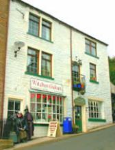
Newchurch clings to the southern slopes of Pendle Hill. The village is famous for St Mary's church and its curious 'eye of God' on the tower which watches over the village. The church was built in 1544 by the inhabitants of the five 'booths' of which Goldshaw Booth is now the village parish. The word 'booth' is thought to come from the Norse word 'but' meaning dwelling place. Only the lower courses of the sixteenth century tower now remain, the rest of the 'New' church was rebuilt in 1735. The grave of the Nutter family can be found in the churchyard, and you can find out more about them and the other 'Pendle Witches' at the little shop 'Witches galore' with its coven figures outside. Newchurch hosts a rushbearing ceremony each August with a procession around the village followed by crowning of the rushbearing queen and a Thanksgiving service in the church. Newchurch was awarded best kept hamlet in Lancashire in 2007.


Newton in Bowland

Newton in Bowland

The journey to this attractive spot over Waddington Fell provides views of breathtaking beauty. John Bright the Quaker spent two years of his early life here in the heart of the Hodder Valley. The Friends Meeting House dates from 1767.


Roughlee

|Roughlee

Roughlee - best kept small village in Lancashire for 2006 and champion village in 2007 - is probably best known for its links to the Pendle Witches story, and its proximity to Pendle Hill. However Roughlee also has an important place the history of non conformist religion. John Wesley and his friend William Darney preached at Roughlee between 1747-57, they were stoned and chased away the first time. Originally they preached outdoors or in the cottages, but eventually a Wesleyan Chapel was built in Barley Green in 1837.A small village of just 270 people, Roughlee is a vibrant community and a popular place to visit with its pretty riverside and waterfalls of Pendle Water (a remnant of the mills that used to be here). The village offers a pub, village community centre, trout fishery and caravan parks. The village is well served by public transport which links it to Burnley, Colne and Clitheroe as well as its neighbours Barley and Newchurch.


Sabden

Sabden

Sabden was a farming valley from the 13th century onwards, and you can still see the remains of 'vaccary walls' from this time in some areas. From the 19th century the farms prospered as they supplied milk, wool and meat to the nearby developing towns of East Lancashire. Sabden also developed its own industries, with calico printing, cotton spinning and weaving all taking place at the Union, Victoria and Cobden mills. Union mill carried on weaving until 1964, and today it houses Pendle Antique Centre; whilst Victoria mill became a carpet factory in its later life. Richard Cobden was an important figure in the 1840's Free Trade movement and he founded Sabden Primary School in the village in 1836 - one of the first in the country to be independent of any church.Sabden is known for the 'deerstones' a series of large millstone grit boulders supposedly showing the Devil's footprints from when he jumped from Hameldon Hill to Pendle, carrying an apron full of stones - hence 'Apronful Hill' near to the Nick of Pendle!


Sawley

Sawley Abbey - image by Charlie Hedley

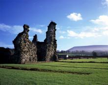
Sawley village grew up around the ruined Sawley Abbey, on the banks of the river Ribble. Its name refers to 'the damp spot where the willows grow'. The Abbey was founded by William Percy II in 1147, after he was given the land by William the Conqueror. Situated on a busy north-south road even then, the Cistercian Abbey provided accommodation for travellers and this made it an expensive place to run. The Abbey was never prosperous but it survived until 1537, when the monks abandoned it due to the failed Pilgrimage of Grace which attempted to challenge Henry VIII's orders to close the monasteries. The stone was plundered to build the village and now only part of the church and fragments of the cloisters remain.


Scorton

Scorton - image by Jon Sparks

Scorton village in the parish of Nether Wyresdale, along the road from Garstang, developed around the cotton mill and railway in the nineteenth century, although there are records of the village and catholic church in Scurton, or Scorton, tracing back to the seventeenth century. Today the village is a popular destination for walkers and cyclists seeking refreshment at the Priory Inn, together with visitors to the Barn. Nearby landmark Nicky Nook is a popular climb, and the fisheries at Wyreside Lake and Cleveley Mere are well worth a visit too.


Slaidburn

Slaidburn

Slaidburn is a picturesque grey stone village set on the banks of the Hodder in the moorland region of the Forest of Bowland National Landscape. The 10th century 'Angel Stone' carving can be seen at Slaidburn Heritage Centre. The centre provides tourist information and houses displays, artifacts and an audio-visual presentation about the village's heritage and the Forest of Bowland. The church of St. Andrew is mostly fifteenth century but has a history that can be traced back over ten centuries. Here you can see an 18th century three-decker pulpit complete with fringed cushions, massive ancient doors, a Jacobean chancel screen and unusual undisturbed Georgian box-pews which still retain the makers adze marks. Much of the woodwork is seventeenth century.Fishing is available on a 2.5 mile stretch on the River Hodder at Slaidburn on specified banks between Hammerton Hall and Great Dunnow.  Full details are available at the Central Stores in Slaidburn - 01200 446268

Slaidburn Archive Website


Tosside

Tosside

Tosside's origins go back to the dark ages when Britain was invaded by the Vikings. It's name comes from two old Scandinavian words - 'Tod' meaning fox and 'saetr' meaning high summer pasture. The name gradually changed to Toddsett, then Tossett and, later, Tosside. Tosside stands, literally, on the Lancashire and North Yorkshire border, with half the village being in a different county from the rest. The village boasts a thriving modern community centre, the Dog and Partridge pub and a large caravan and holiday home site at Crowtrees.


Waddington

Waddington - image by Jon Sparks

Its babbling brook and the beautiful Coronation Gardens have earned this village the title of 'Best Kept Village in Lancashire' on many occasions, before 1974 it was often the best kept in Yorkshire too! The village gets its name from Wadda, an Anglo Saxon chief who was implicated in the murder of Ethelred the Northumbrian King. Waddow Hall was originally a Tudor house built by the Tempest family, it now houses the Girl Guide Association and acts as an activity centre. Henry VI (Henry the Good) lived for 12 months at Waddington Hall before being betrayed to the Yorkists in 1465. He escaped via a secret panel and staircase from the dining room but was captured down river at Brungerley Bridge on the outskirts of Clitheroe. The Almshouses in the village were originally built in the 1700s, and then rebuilt on their present location around the green. Robert Parker founded them for the widows of local dalesmen and farmers.


Wennington

Wennington

Wennington Hall dates originally from the 14th century, but the building you see today is a Victorian reconstruction, now used as a school. The village green would have been the site of both markets and fairs in past centuries and an old pound can be seen on the left near to the river, where stray animals would have been secured. The former Punch Bowl Inn, overlooking the green, is long closed. The narrow bridge over the River Wenning marks the boundary of the old Norman Lordship of Lonsdale.


Wigglesworth

Wigglesworth

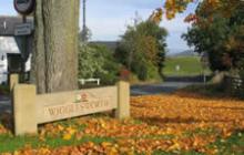
Wigglesworth lies just outside the boundary of the National Landscape, but is on an important route linking Settle to the eastern part of Bowland. The name of the village is believed to have originated in Saxon times: from 'wicel' being the name of a person, or 'wincel' meaning 'of the child' forming the first part, with the last part 'worth' deriving from the Anglo-Saxon word 'wory', pronounced 'worth'.


Wray

Wray

At one time Wray was a local textile centre with silk mills, tanners and coopers, clog and basket makers, taking advantage of the fast flowing waters of the Roeburn and Wenning. The sublime mix of 17th century yeoman's houses with cottages and alleys dating from the 18th century, give this village considerable character, as do the cobbles and corbelled doorways. Visit during the May Bank holiday and find the village inhabited by scarecrows during the annual scarecrow festival.